Toolik Lake Permanent Vegetation Plots
Walker D.A. and Barry N. 1991. Toolik Lake permanent vegetation plots: site factors, soil physical and chemical properties, plant species cover, photographs, and soil descriptions. Data Report 48, Department of Energy R4D Program, Institute of Arctic and Alpine Research, University of Colorado, Boulder, CO.
Home //
Plot location map //
Preliminary vegetation classification //
Communities and microsites //
Environmental variables //
Environmental information: Abiotic data,
Biotic data //
Soils Characteristics //
Species Composition //
Selected Soil Descriptions //
Plot Photos
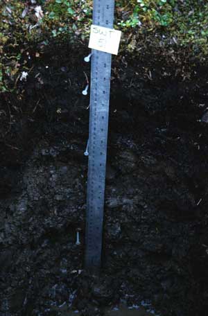
Soil Physical Properties, Plot SWT-51
|
 | | | Sample No. | Horizon | Depth | Wet color | Bulk density | % Gravel | % | % | % | Texture | % H20 | % |
|---|
| (cm) | (g/cc) | >2 mm | Sand | Silt | Clay | 1 atm | 1/3 atm | 15 atm | OM |
|---|
| (1/240) | BAR | |
|---|
| | T-124 | Oe | 4 - 9 | 7.5YR 2/1 | 0.14 | | **** | **** | **** | **** | 282.4 | **** | **** | 50.1 | | | T-125 | Oa | 9 - 24 | 10YR 2/2 | 0.38 | | 36 | 56 | 8 | SiL | 188.0 | 82.1 | 68.2 | 29.6 | | | T-126 | II Bw | 24 - 45 | 10YR 4/3 | 1.89 | 45 | 48 | 26 | 26 | SCL | 14.5 | 20.2 | 10.2 | 3.2 | | | T-127 | II C | 45 - 53 | 10YR 4/3 | 2.15 | 42 | 76 | 12 | 12 | SL | 12.9 | 7.2 | 4.1 | 0.5 | | *1 = routine analysis + hydrometer particle size + gravel (1 fraction) + CaC03 equiv. + Ca, Mg, Na, K + CEC
*1a = same as (1) but with water: field capacity, available, hygroscopic
**2 = same as (1) but without gravel fraction
**2a = same as (1) with water: field capacity, available, hygroscopic
***3 = routine analysis + CEC
**** = Insufficient sample
# = Bray P on samples with pH<6.0
## = Not analyzed |
|
| Enlarge soil photo |
 |


