Alaska Arctic AVHRR False-color Infrared Base Map
- AATVM
- Vegetation
- Bioclimate Subzones
- Floristic Provinces
- AVHRR
- Elevation
- Lake Cover
- Physiography
- NDVI and Phytomass
- Substrate Chemistry
- Literature

| Available data: | ||||
| |
GE |
Metadata |
GIS data |
GIS data |
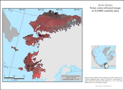
This is the base image used to map the vegetation and other landscape features. The false color-infrared image is derived from Advanced Very High Resolution Radiometer (AVHRR) satellite data. The colors simulate the rendition of the terrain similar to how it would appear on color infrared film, with green vegetation shown as red colors, soils and bedrock as shades of gray, and water appears black. Each picture element (pixel) is 1.1 x 1.1 km. The image displays the highest infrared reflectance (greenest value) for each pixel during two years of AVHRR data (1993 and 1995) (Markon et al. 1995).


