Toolik Lake Area SPOT False-Color Infrared Image
- Toolik Area
- Vegetation
- Elevation
- SPOT
- Landforms
- Releve Locations
- Glacial Geology
- Percent Water
- Surficial Geology
- Surficial Geomorphology
- Soil Carbon
- Literature
| Available data: | ||||
 |
 GE |
 Metadata |
 GIS data |
 GIS data |
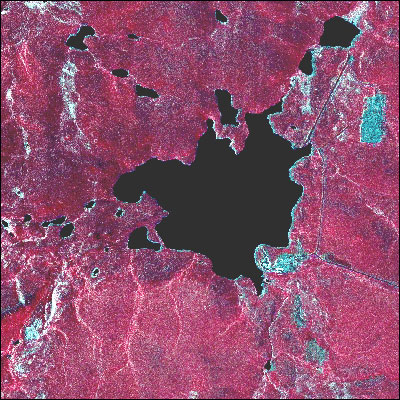
This is a subset of the Upper Kuparuk Region False-Color Infrared Image. The French SPOT satellite data (20-m resolution) were obtained on 28 July 1989 and provides a view of the mapped region from space. The false-color infrared image shows more densely vegetated areas as brighter red tones.
 |
|
| The University of Alaska Fairbanks is an affirmative action/equal opportunity employer and educational institution. | |
|
Loading
| |
Last modified: January 17, 2012